Project Area
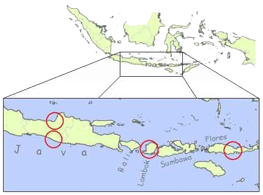
Click on the map to get information about our project regions
City of Yogyakarta & DIY Province, Central Java :
 |
|
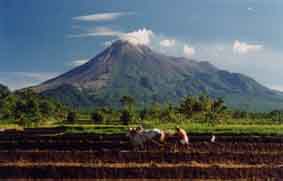
The City of Yogyakarta is located between the SouthJava See and the Merapi Mountain, one of the most active volcanoes in the world. Its long history is founded on the region's fertile soils, which were provided by the mountain's regular eruptions. Today the Merapi region is one of the most densely populated areas in Indonesia with in parts more than 1400 inhabitants per km2. But these big agricultural advantages are dampened by the permanent threat Merapi poses to its surroundings:
| ..... |  |
|
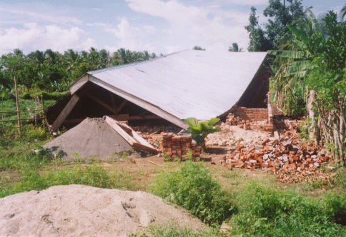
The history of deadly eruptions goes back to 1006 AD, when a disastrous
explosion led to the go down of the Mataram kingdom.
During the last centuries about every 50 years a major eruption occurred,
often claiming hundreds or thousands of lives and homes and setting back
the development of vast areas. The last time in 1930, 1369 people were killed
and about 1109 houses destroyed. But even since that time every couple of
years, minor eruptions threaten the settlements on the mountains' slopes.
Although the scientists gave an early warning that led to the evacuation
of more than 5500 people, on the 22. November 1994, 66 people got killed
in a pyroclastic flow.
But not only the Merapi poses a risk to the population: Soil erosion and
landslides endanger the area's agricultural productivity, which still today
for many people is the major source of income.
City of Semarang, Central Java:
The city of Semarang in Central Java is a major shipping-port, which supplies the region with goods and enables trading. For this, the city is not only home to 1.4 million people, but also to many important industries.
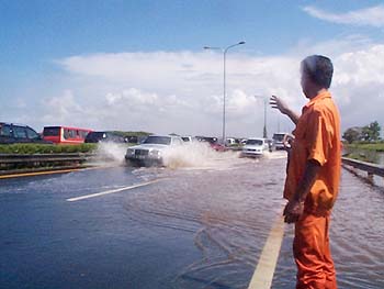 |
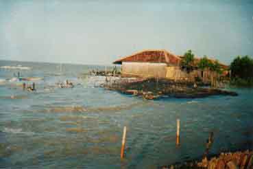
The
old town and many new industrial areas are located on young alluvial sediments,
which are prone to compression. Although subsidence is a quiet normal process
on land like this, in Semarang it is further enhanced by the extraction
of drinking water and the weight of buildings.
The station hall of Semarang, built in colonial times at two meters above
see level, sank about 2.75m and today lies under the average water table
of the nearby coast. For the same reason a high percentage of Semarang's
populated area is permanently flooded, a situation which is growing increasingly
serious every rainy season:
| ... | 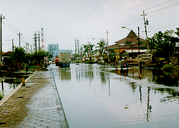 |
The
ground floors of many houses can not be used any more and have to be filled
up with gravel, bought expensively from mining companies. Although these
floods usually do not endanger lives, they are a heavy burden for the affected
population.
One could think moving would be the best solution for Semarang's citizen,
but the surrounding hills are heavily endangered by landslides, which frequently
destroy houses and claim lives.
Mataram, the capital of the province Nusa Tenggara Barat is located on the west coast of the island of Lombok, which is affected by a broad variety of natural disasters:
 |
 |
Reducing the risks in this very complex situation requires an overall approach to evaluate all areas of danger and set up a mitigation strategy involving as many local groups and organizations as possible. For this reason Mataram and Lombok can be seen as a case study about how to reduce georisks all over Indonesia.
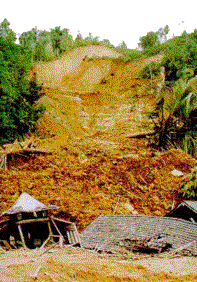
Early April 2003 the city of Ende and its surroundings experienced torrential rainfalls caused by a tropical cyclone. Several landslides and mudflows destroyed houses, roads and bridges and the area was isolated for one week during which the death toll rose to at least 27 and many people were reported missing.
 |
The disaster received considerable media attention:
CNN
DPA
A survey about this disaster found out that the impacts was amplified by human activities such as small-scale mining and the habit of burning vegetation before planting. Although there is a regulation prohibiting mining on slopes prone to landslides it was not completely translated into action.
The
City of Ende and its surroundings at the Island's north-coast also suffered
from landslides in early April 2003 but the main problem is its location
close to one of Indonesia's most dangerous seismic areas:
 |
|
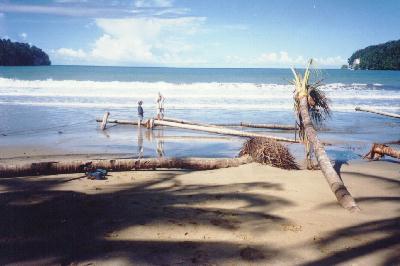
The
12 December 1992 a disastrous tsunami was generated by an offshore earthquake
and swept away several villages and cities. Although many inhabitants were
able to flee to higher ground, 1.690 people were reported killed and about
18.000 houses destroyed. Besides the casualties and damages to settlements
and infrastructure along the Island's north-coast, a high percentage of
Flore's corral reefs were severely damaged, reducing the area's touristic
potential. A detailed description of the event is published by the
USC Civil Engineering Department.
Back to the top ...